

What is Preliminary Survey
Preliminary surveys also referred to as pre-engineering surveys, location surveys, or data-gathering surveys, are a method used to gather information about the location of natural and built features. These surveys collect measurements that help identify the position of natural features like trees, rivers, hills, and valleys, as well as the position of built features such as roads, buildings, pipelines, and more.
Techniques Used in Preliminary Surveys
Measured tie-ins can be accomplished by any of the following techniques.
1. Rectangular Tie-Ins
Back in the day, one of the most popular ways to determine the location of a point during preelectronic surveys was by using the rectangular tie-in method, also known as the right-angle offset tie. This technique involves using measurements to locate point P, shown in Figure (a), to the baseline AB. To do this, you need to measure the distance AC (or BC), where point C is located on AB at a right angle (90° to point P. You also need to measure the distance CP.
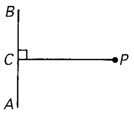
Figure (a) – Rectangular Tie-Ins
2. Polar Tie-Ins
Nowadays, the polar tie-in method, also known as the angle/distance technique, has become the most widely used technique for determining location. To use this method, you locate point P, as shown in Figure (b), from point A on the baseline AB by measuring both the angle u and the distance AP.
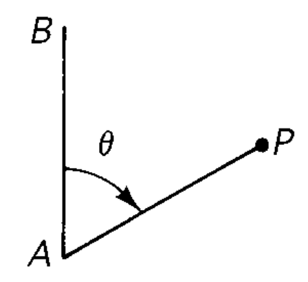
Figure (b) – Polar Tie-Ins
3. Intersection Tie-Ins
The polar tie-in method is particularly valuable for specialized location surveys. To determine the location of point P in Figure (c) relative to baseline AB, you can use two techniques: the angle intersection technique and the distance arc intersection technique.
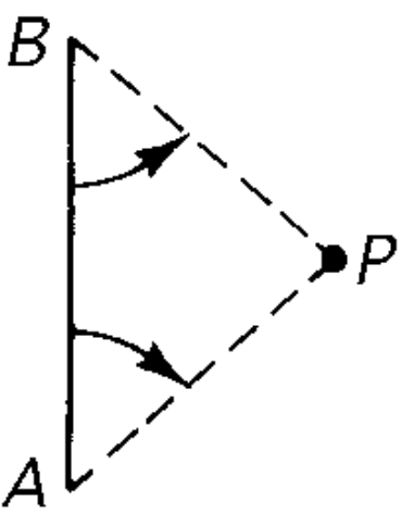
Figure (c) Intersection Tie-Ins
In the angle intersection technique, you measure the angles from both points A and B to point P. Alternatively, you can use the distance arc intersection technique by swinging out arc lengths AP and BP until they intersect.
The angle intersection technique is especially useful for nearshore marine survey locations when theodolites or total stations are set up on shore control points. The distance arc intersection technique is also effective when trying to replace “lost” survey points from preestablished reference ties.
4. Positioning Tie-Ins
The technique that comes in second for locating topographic features involves direct positioning techniques that are commonly used in ground-scanning, satellite-positioning, and remote-sensing methods.
Also Read: What is Reconnaissance Survey in Civil Engineering
Leave a comment